One of the most remarkable things about climbing Kilimanjaro is that you pass through five distinct climate zones in a single ascent. In 6 to 9 days of walking, you move from tropical cultivated farmland to lush rainforest, then through alpine moorland, arid high-altitude desert, and finally into an arctic summit zone with permanent glaciers. That vertical compression of climates is rare — you’d have to travel from the equator to the Arctic Circle to see the same variety at sea level.
Each zone has its own temperature, vegetation, wildlife, and its own effect on how you feel. Understanding them helps you pack properly, pace yourself properly, and notice what’s actually around you as you climb.
The Five Zones at a Glance
| Zone | Altitude | Character |
|---|---|---|
| Cultivated zone | 800–1,800 m (656-6,102 ft) | Farmland, villages, coffee plantations |
| Montane rainforest | 1,800–2,800 m (6,102-9,186 ft) | Dense, wet tropical forest |
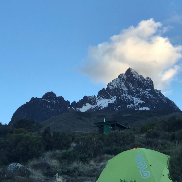
| Heath and moorland | 2,800–4,000 m (9,186-13,123 ft) | Open, cool, giant plants |
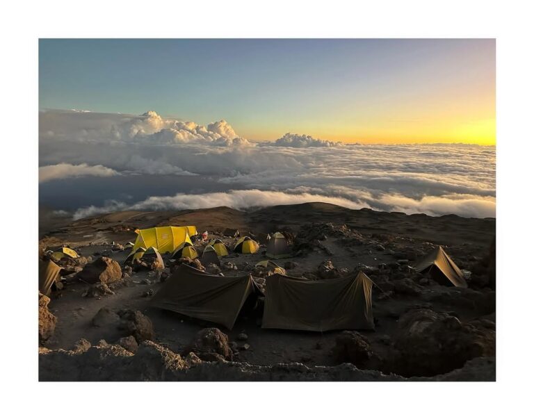
| Alpine desert | 4,000–5,000 m (13,123-16,404 ft) | Arid, rocky, thin air |
| Arctic summit zone | 5,000–5,895 m (16,404-19,340 ft) | Ice, rock, sub-zero temperatures |
You don’t spend equal time in each zone. Most climbers pass through the cultivated zone by vehicle on the drive to the gate, spend one day in the rainforest, two to three days in the heath and moorland, two days in the alpine desert, and a single very long summit night in the arctic zone.
Zone 1: Cultivated Zone (800–1,800 metres/656-6,102 ft)
The base of Kilimanjaro is some of the richest farmland in Tanzania. Volcanic soils, reliable rainfall, and a temperate equatorial climate produce dense cultivation — Chagga smallholdings growing coffee, bananas, maize, and vegetables.
Temperature: 20–27°C during the day, mild nights.
Rainfall: High and reasonably reliable — this zone receives between 1,000 and 1,400 millimetres per year, concentrated in the two wet seasons (March–May and November).
What you see: Farmland, Chagga villages, coffee bushes grown under shade trees, grazing cattle. Your drive from Moshi to the Machame or Marangu gate passes through this zone.
On the climb: You don’t spend meaningful time walking here. The gates for most routes sit at the upper edge of this zone or the lower edge of the next one.
Zone 2: Montane Rainforest (1,800–2,800 metres/6,102-9,186 ft)
This is where your climb genuinely begins. All routes except Rongai start in the montane rainforest — a dense, humid, dripping tropical forest unlike anything most visitors have seen before.
Temperature: 15–22°C during the day, cooler at night. Humidity is high.
Rainfall: This is the wettest zone on the mountain, receiving up to 2,000 millimetres of rain per year. The forest is wet, the trails are often muddy, and rain is possible on any day of any season. Your guide will tell you to keep your rain layer accessible from the first hour.
Vegetation: Towering camphorwood, fig, and podocarpus trees, often 30 metres tall. Below them, tree ferns, mosses, epiphytes, and lichens. The forest floor is damp, dark, and dense.
Wildlife: This is the zone with the highest concentration of animal life on the mountain. Blue monkeys and black-and-white colobus monkeys are frequently seen, especially on the Lemosho route. Bushbuck, duiker, and occasionally elephant tracks appear on quieter trails. Forest birds — turacos, hornbills, sunbirds — are abundant, though dense foliage makes spotting them a challenge.
On the climb: You typically walk through this zone on day 1, reaching your first high camp at around 2,800 to 3,000 metres. The rainforest feels magical. It also surprises climbers with how humid it is — you’ll sweat more than you expect, even in cool weather. Drink more water than feels necessary.
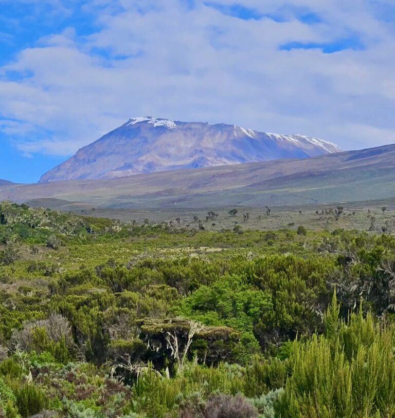
Zone 3: Heath and Moorland (2,800–4,000 metres/9,186-13,123 ft)
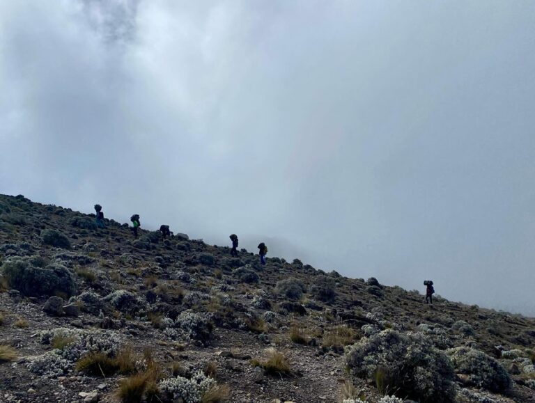
As you climb out of the rainforest, the landscape opens up dramatically. Tree cover thins within a few hundred metres of elevation gain, and you emerge into a high-altitude heathland that feels more like Scotland than tropical Africa — except for the plants.
Temperature: 5–15°C during the day, dropping below freezing at night.
Rainfall: Much drier than the rainforest — 500 to 1,300 millimetres per year, with significant cloud and mist but less heavy rain.
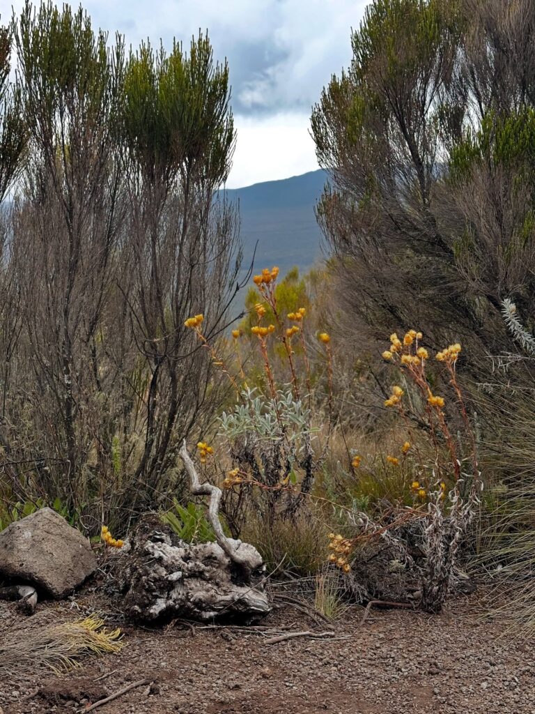
Vegetation: This is the zone of giant groundsels (Dendrosenecio kilimanjari) and giant lobelias (Lobelia deckenii) — two of Kilimanjaro’s most distinctive plants. Groundsels look like tree-sized cabbages, 3 to 6 metres tall, and can live for more than a century. Lobelias form tall rosettes with silvery leaves that close at night to protect against freezing. Heather, tussock grass, and everlasting flowers (Helichrysum) fill the ground cover.
Wildlife: Less dense than the rainforest. You may see mice, four-striped grass rats, and occasionally klipspringer antelope. Ravens, buzzards, and the striking alpine chat are the common birds.
On the climb: You spend one to three days in this zone depending on your route. Acclimatisation walks often happen here — “walk high, sleep low” pattern is easier to execute because the terrain opens up. The air is noticeably thinner than the rainforest; breathing on climbs starts to feel heavier.
The heath and moorland is where climbers usually start to understand why the Swahili phrase pole pole (slowly slowly) matters. Going too fast in this zone is one of the most common mistakes we see — and it often manifests as altitude symptoms two or three days later.
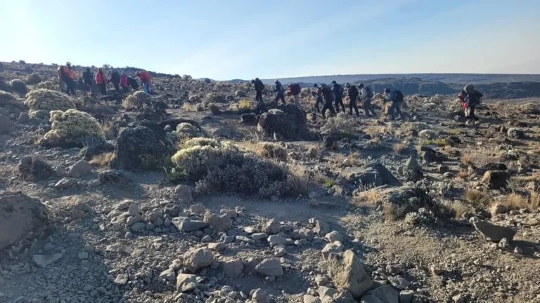
Zone 4: Alpine Desert (4,000–5,000 metres/13,123-16,404 ft)
Above 4,000 metres (13,123 ft), the landscape changes again — this time to something much starker. Vegetation thins to almost nothing. Air becomes noticeably dry. The sun feels sharper because there’s less atmosphere to filter it.
Temperature: -1 to 15°C during the day, -15 to -5°C at night.
Rainfall: Under 250 millimetres per year — drier than some deserts. What precipitation does fall above 4,500 metres often comes as snow.
Vegetation: Scattered tussock grasses, Helichrysum everlastings in rocky shelters, and small mosses and lichens on protected rock faces. Most of the landscape is bare volcanic rock, scoria, and gravel — the skeletal remains of the mountain’s eruptive past.
Wildlife: Almost none. You may see an occasional raven or lammergeier (bearded vulture) riding thermals. Small rodents persist in some sheltered areas, but most of the large wildlife has been left below.
On the climb: This is where the climb gets serious. The Saddle between Mawenzi and Kibo, the Barafu and Kibo Huts areas, and the long approaches to summit camps all sit in this zone. Oxygen is around 55 to 60% of sea level. Most climbers feel the altitude clearly here — headaches, reduced appetite, broken sleep are all common. Our guides check SpO2 (oxygen saturation) morning and evening using pulse oximeters, and will adjust pace and monitoring based on the readings. See our safety page for the full protocol.
Pace in the alpine desert is slow by design. Short steps. Measured breathing. Drink constantly — altitude dehydrates you faster than you realise.
Zone 5: Arctic Summit Zone (5,000 metres and above/16,404+ ft)
Above 5,000 metres (16,404 ft), the mountain enters a true arctic environment. Almost nothing grows. Temperatures drop well below freezing year-round. The air contains roughly half the oxygen you’d breathe at sea level.
Temperature: -7 to 4°C during the daytime (if the sun is out). At summit night, typical readings are -15 to -25°C, and with windchill at the crater rim, effective temperatures can be colder still. Our post on how cold the summit of Kilimanjaro is covers this in more detail.
Rainfall: Almost none. What precipitation occurs is almost entirely snow. The glaciers at the summit are ancient — more snow and ice from millennia past than from any recent weather.
Vegetation: Effectively none. A few lichens cling to rock faces. That’s it.
What you see: Volcanic ash, scoria, hard lava, and the remaining glaciers — the Northern Icefield, Southern Icefield, Furtwängler Glacier, and Rebmann Glacier. The summit crater (Reusch Crater) contains an Ash Pit with active fumaroles releasing volcanic gases. On clear mornings, the view from Uhuru Peak stretches for hundreds of kilometres.
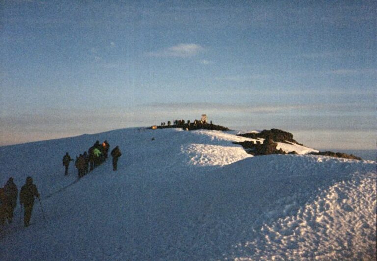
On the climb: You enter this zone on summit night, usually starting your push from high camp (around 4,600 metres/15,091 ft) at midnight and reaching Uhuru Peak at sunrise. You spend roughly 6 to 8 hours in the arctic zone before beginning your descent. This is the most physically demanding part of the climb and, for many people, the defining experience of their trip.
What This Means for Your Packing
Five climate zones means five temperature ranges, which means your gear has to span from rainforest humidity to arctic cold. The layering system most climbers use:
- Base layer: merino wool or synthetic, long sleeves and long legs
- Mid layer: fleece or light down
- Shell layers: waterproof, breathable jacket and trousers
- Summit layer: heavy insulated down jacket, insulated trousers, thick gloves, balaclava
Our Kilimanjaro packing list walks through the full gear list, and we do a gear check at your pre-climb briefing in Moshi to make sure you have what you need. Gear rental is available in Moshi if anything is missing.
The Bigger Picture
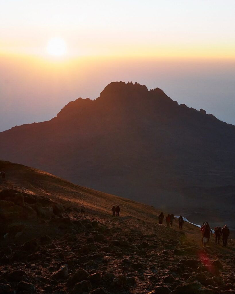
Kilimanjaro’s five climate zones are one of the most compelling features of the climb — you aren’t just moving up in altitude, you’re passing through entirely different ecosystems, each with its own rules. The rainforest teaches humidity. The heath teaches pacing. The alpine desert teaches patience. The arctic summit teaches what your body is capable of.
Pay attention to the transitions. Your guide will point them out, but even the subtle shifts — the first lobelia, the last tree, the first snow — are worth slowing down for.
Ready to walk through all five? Our routes overview covers which routes sample the zones most fully (Lemosho and Machame traverse all five; Rongai starts in a drier northern zone), or contact us directly to plan your climb.