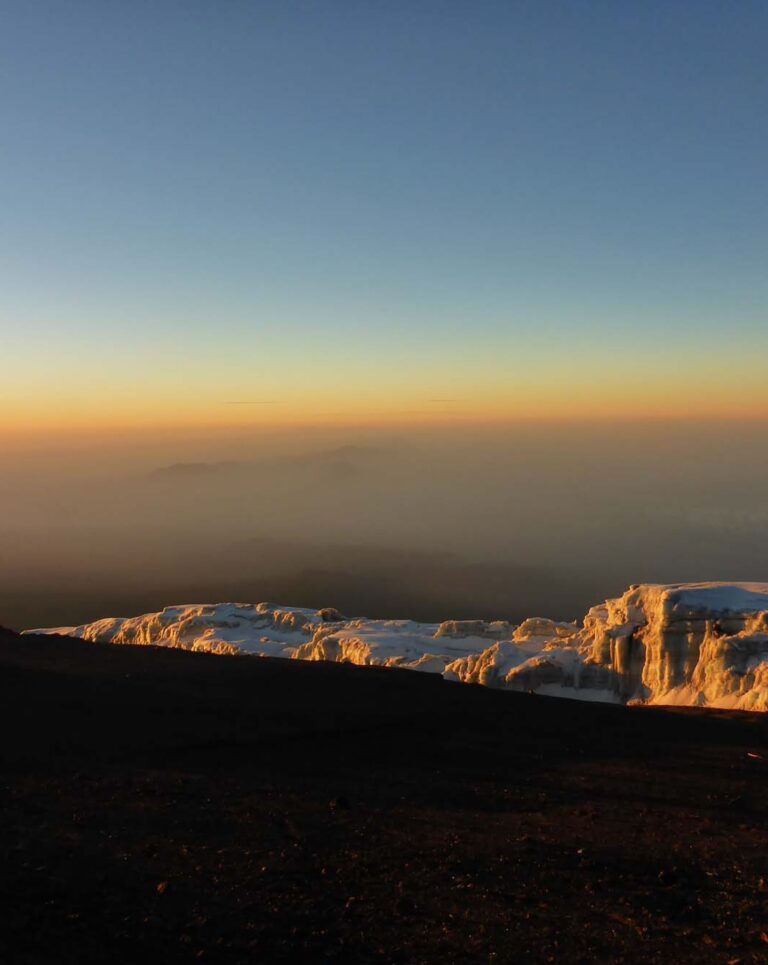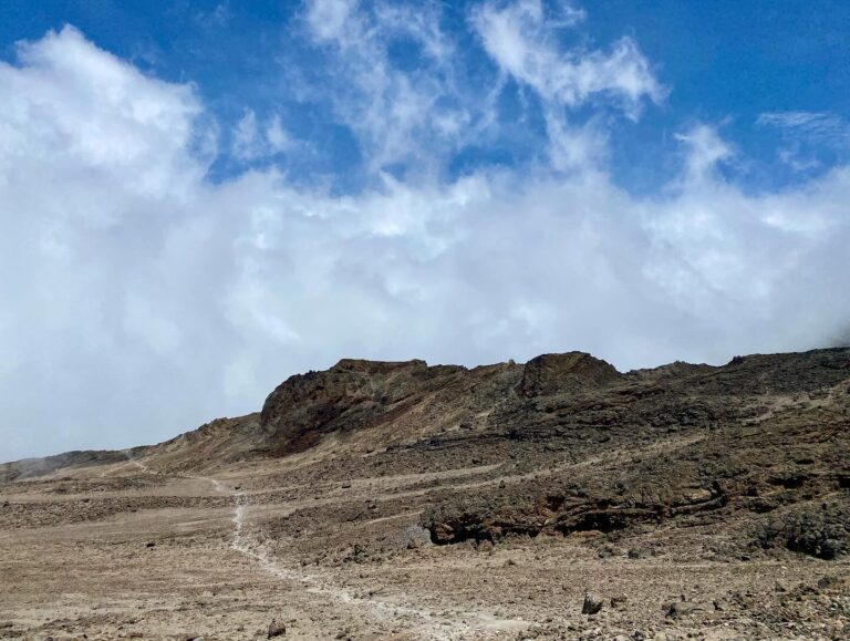
Most people ask about Kilimanjaro weather the same way they’d ask about weather in a city: “Is July good?” “Does it rain?” “How cold does it get?” These are the right questions — they’re just pointed at the wrong unit. The relevant question isn’t “what is the weather like on Kilimanjaro?” It’s “what is the weather like on Kilimanjaro at 2,400 metres? At 3,800 metres? At 5,895 metres?”
The mountain rises nearly 5,000 vertical metres from its base. As it does, it passes through ecological zones that have almost nothing in common with each other. The temperature difference between Moshi at the foot (850m, typically 25–30°C) and Uhuru Peak (5,895m, typically -10°C to -20°C on a summit night) is greater than the difference between London in July and Antarctica in winter.
Understanding that vertical range — not just the seasonal calendar — is what determines whether you pack correctly, choose the right season, and arrive at the summit prepared for what the mountain actually is.
The Mountain Generates Its Own Weather
Before getting into the zones: one essential piece of context that explains a lot of what you’ll experience.
Kilimanjaro rises abruptly from relatively flat, semi-arid surroundings. As moist air from the Indian Ocean and the surrounding plains moves inland, it encounters the mountain’s mass and is forced upward. This process — called orographic uplift — causes moisture to cool and condense against the southern and southeastern slopes. The result: clouds form against the mountain’s middle sections almost every afternoon, regardless of what the regional forecast says. Moshi, 40km away at the base, can be sunny while the forest and moorland zones are draped in cloud.
This is also why there are two distinct weather systems on the mountain at any given time: what’s happening at the summit (above the cloud layer, often clear in dry season) and what’s happening in the forest and heath zones (frequently cloudy). Your guide — who has made this ascent dozens of times — will be reading both simultaneously, tracking how the afternoon cloud is developing from camp before your summit push.
The practical implication: general weather apps are unreliable for on-mountain conditions, particularly in the middle altitude zones. Route-specific guide knowledge matters more than a ten-day forecast.
Kilimanjaro Weather Chart
KILIMANJARO WEATHERKilimanjaro Wind Animation (Live)
Temperature by Altitude Zone
Here’s what to actually expect at each altitude band — in both Celsius and Fahrenheit, because packing decisions are more intuitive when you can picture the number.
Cultivated Zone: 800–1,800 m = 2,625–5,906 ft
| Metric | Value |
|---|---|
| Daytime high | 25–30°C (77–86°F) |
| Night low | 15–20°C (59–68°F) |
| Annual rainfall | 500–1,800mm |
Warm, often humid. This is Moshi and the coffee-growing foothills. Mornings are typically clear; afternoons may bring light rain or cloud. You’re driving through here on the way to the trailhead, or spending time at the Ekanubi Underground cultural experience or the coffee tour.
Montane Forest Zone: 1,800–2,800m = 5,906–9,186 ft
| Metric | Value |
|---|---|
| Daytime | 15–25°C (59–77°F) |
| Night | 8–15°C (46–59°F) |
| Annual rainfall | 1,000–2,000mm |
| Humidity | Very high |
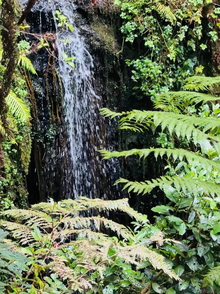
This is the wettest zone on the mountain. The forest intercepts the cloud and mist that forms against the southern slopes, and it shows: the canopy is draped in mosses, epiphytes, and hanging lichens. You’ll spend day one and often day two here, moving through Hagenia, podocarpus, and fig trees with Colobus monkeys overhead.
Rain is common even in the dry season. In the morning, you’ll often leave camp in sunshine. By early afternoon, cloud rolls in from the south and drizzle begins. Don’t assume a July departure means a dry forest zone — it frequently isn’t. A proper waterproof jacket (not water-resistant — waterproof) is non-negotiable here regardless of season.
In the long rains (March–May), this zone is frequently very wet, trails are slippery, and roots and rocks become hazardous. The short rains (November–mid-December) produce similar but less intense conditions.
Heath and Moorland Zone: 2,800–4,000 m = 9,186–13,123 ft
| Metric | Value |
|---|---|
| Daytime high | 10–15°C (50–59°F) |
| Night low | -4 to 0°C (25–32°F) |
| Annual rainfall | 530–1,300mm |
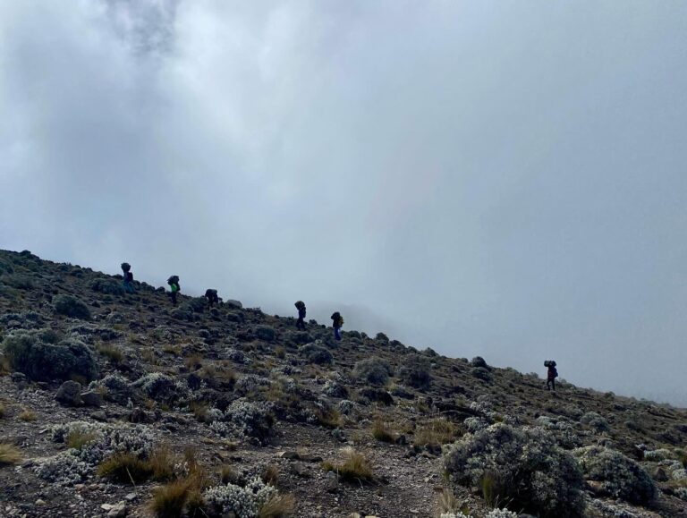
Above the treeline, the landscape opens into giant heather (Erica arborea) and then moorland with giant groundsel (Senecio kilimanjari) — plants that evolved specifically for high-altitude tropical conditions. Nothing quite like them grows anywhere else on earth.
The weather pattern here is characterised by strong diurnal swings: mornings are cold and often clear, afternoons warm with solar heat before cloud arrives from the south, evenings drop sharply. You can gain 15°C in warmth between 8am and noon and lose it again by 4pm.
Nights at 3,800m are consistently below freezing. Your insulating mid-layer (fleece or down) becomes necessary at camp from this zone upward. Rain in this zone comes as short, intense showers rather than the persistent drizzle of the forest — but in rainy season, the moorland trails hold water and become difficult.
Alpine Desert Zone: 4,000–5,000 m – 13,123–16,404 ft
| Metric | Value |
|---|---|
| Daytime | -5 to 5°C (23–41°F) |
| Night / Pre-dawn | -10 to -15°C (14 to 5°F) |
| Annual rainfall | <250mm |
“Desert” is accurate here: annual precipitation is below 250mm, and the landscape is volcanic rock, dust, and sparse grasses. After the green, draped forest, this zone feels stark and exposed. But desert doesn’t mean warm — especially at night.
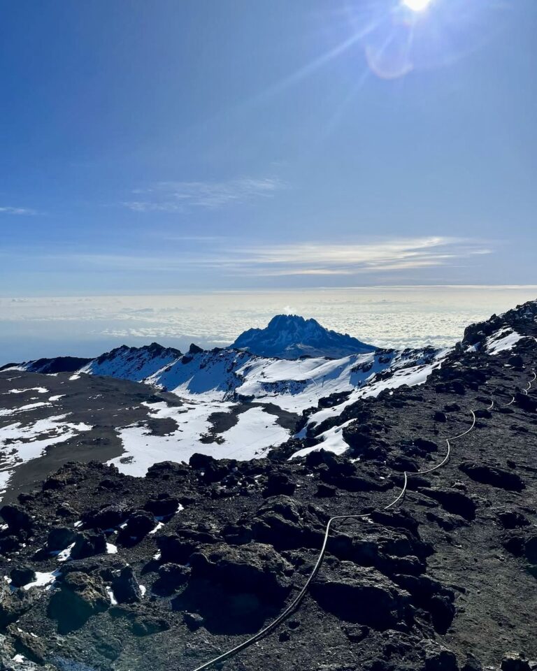
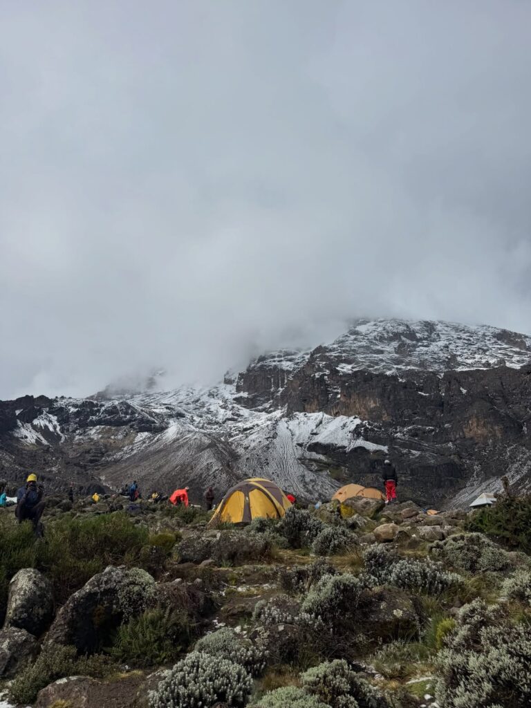
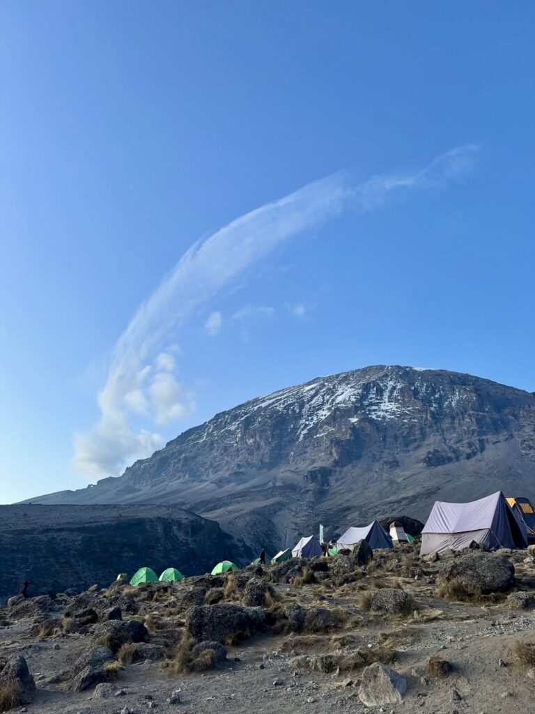
Barafu Camp sits at 4,673m and is the summit staging point on Machame and Lemosho. You’ll arrive here in the afternoon, rest, eat, and try to sleep before the midnight wake-up for the summit push. Daytime temperatures at Barafu in peak season sit around 0°C, and by midnight when you’re moving they’ll be -10°C to -15°C, with wind chill potentially reaching -20°C.
Wind becomes a critical factor here. Above the treeline and the moorland, there’s no shelter. Open slopes and ridges are exposed to whatever is moving across the mountain. Gusts above 50km/h are possible; on bad days near the crater rim, wind can be significantly stronger. Wind chill transforms what a thermometer reads into what your body feels — and at altitude, where your body is already prioritising oxygen delivery to vital organs over peripheral heating, the cold cuts more deeply than it would at sea level.
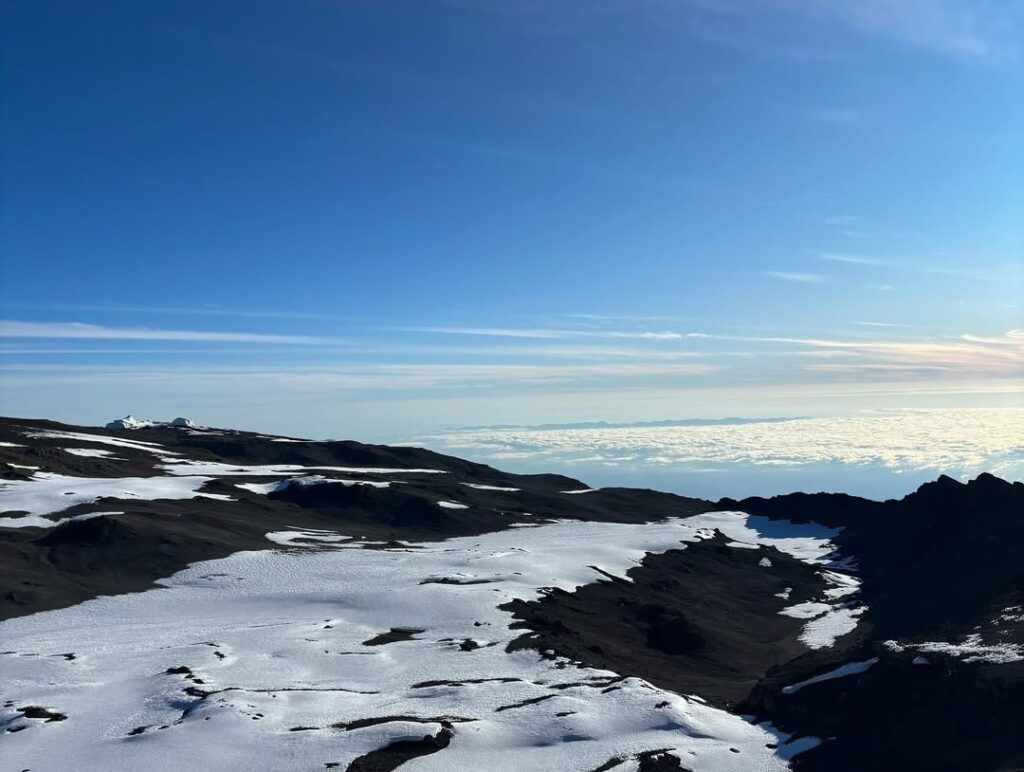
Arctic Summit Zone: 5,000–5,895 m = 16,404 – 19,341 ft
| Metric | Value |
|---|---|
| Average summit temp (peak dry season, night) | -10 to -20°C (14 to -4°F) |
| With wind chill | -20 to -30°C (-4 to -22°F) |
| Daytime summit (clear day) | -5 to 0°C (23–32°F) |
| Precipitation form | Snow and ice |
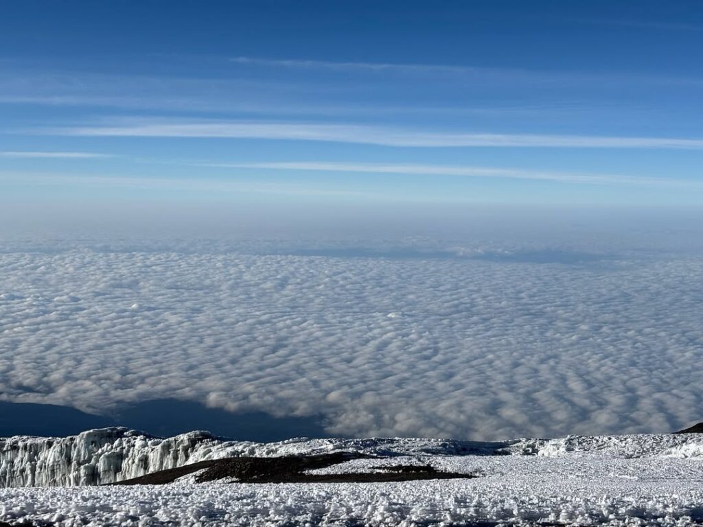
Above 5,000 m / 16,404 ft, Kilimanjaro is comparable in conditions to much higher Himalayan or Andean environments. Average annual temperatures are below freezing. Precipitation falls as snow. The glaciers that still exist on the mountain — the Lewis Glacier, the Furtwängler Glacier, the Northern Ice Field — are the remnants of a once-massive ice cap that has been retreating for decades.
Summit temperatures vary by season, by time of night, and by whether cloud or clear sky is overhead:
Hour-by-hour progression on a typical summit night (peak season, Machame/Lemosho):
- Midnight departure from Barafu (4,673 m / 15,331 ft): approximately -10 to -12 °C
- 2 am, approaching Stella Point (5,756 m / 18,885 ft): -14 to -16 °C, wind increases
- Summit (5,895 m / 19,341 ft) before dawn: -16 to -20 °C with wind chill; coldest point of the climb
- Sunrise at the summit: temperature begins to rise modestly; wind often drops slightly
- Descent through alpine desert: air warms quickly as the sun comes up
This is not an abstract description — this is what your body will experience. The 2 am–4 am window is the hardest part of a Kilimanjaro climb for most people, and it’s hard partly because the cold adds to the altitude challenge. A climber who is slightly underequipped (inadequate down jacket, no insulated trousers) will feel the difference viscerally at 5,400 m / 17,717 ft at 2 am.
Why Altitude Multiplies Cold
This is worth understanding because it changes how you think about packing.
At altitude, your body faces a competing demand problem. The thin air (at 5,895 m / 19,341 ft, air pressure is roughly half that at sea level) forces your cardiovascular system to prioritise oxygen delivery to your heart, lungs, and brain. Your peripheral circulation — the system that normally keeps your hands, feet, and skin warm — gets de-prioritised.
The result: -15 °C at altitude feels significantly colder than -15 °C at sea level, because your body’s ability to generate and distribute heat is compromised. A down jacket that would keep you warm on a cold January day in London or New York may not be adequate at Barafu Camp at midnight. The rating on a sleeping bag or jacket assumes normal physiological function. At altitude, that assumption doesn’t hold.
This is why the guides at Kilimanjaro Sky are emphatic about gear: they see the difference every climb. Clients who arrive with properly rated gear — a serious down jacket rated to -10 °C or below, insulated wind trousers, quality liner and outer gloves — have a measurably different summit night experience than clients who cut corners on insulation.
UV intensity follows the same principle. At 5,000 m / 16,404 ft, UV radiation is 40–50% more intense than at sea level due to thinner atmosphere. Even on overcast days, UV exposure at the summit is significant. SPF 50 sunscreen, UV-rated glacier sunglasses (wrap-around style), and SPF lip balm are not optional above 3,500 m / 11,483 ft.
Seasonal Calendar: Month by Month
January — Dry Season (Excellent)
January is one of the best months to climb and one of the most underused. The long rains have finished, trails are in good condition, and summit nights are frequently clear. January can have some residual moisture in the lower zones from December, but by mid-January conditions are typically excellent. Fewer climbers than peak season. Good availability.
February — Dry Season (Often Our Best Month)
February is the month our guides most often cite as their personal favourite. Clear summit nights, stable conditions across all zones, low traffic. The only reason February isn’t crowded is that most climbers from the US and UK haven’t adjusted their mental calendar to include it as “Kilimanjaro season.”
March — Transitional (Variable, Early March Usually OK)
The long rains begin building toward end of March. Early March is often still good — similar to late February. From around mid-March, conditions start deteriorating in the lower zones. If your schedule lands in March, lean toward an earlier date and consider the Rongai Route (see below for why the northern approach handles wet season better).
April — Long Rains (Difficult)
April is the wettest month on the mountain. The forest and moorland sections are frequently wet and slippery. Summit visibility is compromised more often. Success rates are lower — not catastrophically, but noticeably. Some climbers choose April specifically for the dramatic, misty atmosphere and lower prices. If summit success is your priority, this is not the month to choose.
May — Long Rains (Difficult)
Similar to April. The second half of May begins to ease as the long rains approach their end, but conditions remain challenging.
June — Dry Season Beginning (Good)
By late June the mountain has dried significantly. June is the start of the main dry season and a solid choice — good conditions, lower prices than peak season, trails in good shape. An underrated month.
July — Peak Season (Excellent Conditions, High Crowds)
July is peak Kilimanjaro. Summit conditions are as good as they get — stable, dry, clear nights. Barafu Camp is at its busiest; on Machame and Lemosho, the final ascent carries significant traffic. Popular departure dates book months ahead. If you’re flexible within this window, the last week of June through first week of July is often less crowded than the school-holiday peak.
August — Peak Season (Excellent Conditions, Highest Crowds)
August is the busiest month on the mountain. Conditions match July. If you’re climbing in August, book four to six months ahead.
September — Excellent (Underrated)
September conditions are nearly identical to August. Traffic drops noticeably — this is the month many guides prefer for the balance of excellent conditions and real quiet on the mountain. If you have flexibility within the June–October window, September is the choice.
October — Transitional (Usually Fine)
October is typically still good, though short rain activity can begin toward the end of the month, particularly on the southern slopes. Early October is similar to September. Late October brings some variability.
November — Short Rains (Variable)
The short rains arrive in November. Less severe than the long rains, but significant enough to affect lower zone conditions. The first two weeks of November are typically the most challenging. By late November, conditions often improve. Some climbers time a late-November departure to catch improving conditions before December prices and availability tighten.
December — Variable (Mid-Month Onward Good)
The short rains typically clear by mid-December. From approximately December 10–15 onward, conditions are usually good and continue improving. December is a popular window for climbers wanting to frame a year-end with something significant — the mountain is quieter than peak season, and conditions from mid-month are reliable.
Route-Specific Weather: Why the North Side Differs
Not all routes experience the same weather. The distinction matters most during the wet seasons.
Southern routes (Machame, Lemosho, Marangu, Umbwe, Shira) approach from the south and southwest. These slopes directly receive the moist air driven by the southeast trade winds and orographic uplift. In the long and short rains, the forest and moorland sections on these routes are the wettest parts of the mountain.
Rongai and Northern Circuit approach from the north, from the Kenyan border side. The northern slopes sit in the mountain’s natural rain shadow — protected from the moisture-bearing southeast flow. During the long rains (March–May) and short rains (November), the Rongai Route is significantly drier at lower elevations than the southern approaches.
If your schedule forces you into the wet season windows, Rongai is the practical answer. It’s not completely dry — above 4,000m, the mountain’s weather patterns converge and route doesn’t protect you from summit-level conditions. But the lower and mid-mountain sections are meaningfully more comfortable.
Rongai also runs quieter than Machame and Lemosho year-round. In wet season, when most climbers avoid the mountain, the trail can feel almost entirely private.
For the full route comparison, see our Kilimanjaro routes guide.
What Weather Means for Summit Success
Weather is a factor in summit success, but it’s not the primary factor. Our success rate of 95–98% on Machame and Lemosho holds across the calendar — including in months where conditions aren’t perfect at lower elevations.
What weather actually does is compound other variables. A climber who is borderline on acclimatisation will be more affected by summit cold and wind. A climber who is mildly dehydrated will feel the cold more acutely. Wet conditions on the lower mountain over multiple days affect morale and energy before the summit push.
The more consequential variable than season is route duration. An eight-day Lemosho gives your body significantly more acclimatisation time than a five-day Marangu, and this matters more to your summit odds than whether you’re climbing in September versus October. See our altitude sickness guide for the physiology behind why duration is the primary lever.
What guides at Kilimanjaro Sky watch before a summit departure: how the cloud is building during the afternoon before the midnight start. The speed of build, the height it reaches, whether wind picks up from the west. A good lead guide reads this correctly. They’ll adjust departure timing by an hour when the mountain’s weather pattern calls for it — not rigidly following a schedule. We’ve had successful summits on nights that looked uncertain from Barafu Camp, and we’ve adjusted course on nights that looked clear. The mountain moves quickly. Experienced judgment in real time is what matters.
Practical Implications: How to Pack for What’s Coming
| Zone | Key Weather Reality | What You Need |
|---|---|---|
| Forest (1,800–2,800m) | Rain likely even in dry season | Waterproof jacket (full waterproof, not resistant) |
| Heath/moorland (2,800–4,000m) | Cold nights; layering daily | Fleece mid-layer; packable down |
| Alpine desert (4,000–5,000m) | Wind exposed; diurnal extremes | Shell layer; wind-blocking trousers |
| Summit zone (5,000m+) | -10 to -20°C with wind; altitude multiplies cold | Serious down jacket (-10°C+ rating), insulated trousers, balaclava, outer mittens |
For the complete gear system, see our Kilimanjaro packing list, which covers the layering framework zone by zone. If you have questions about whether what you own is appropriate for specific conditions, get in touch before your trip — our guides are happy to advise.